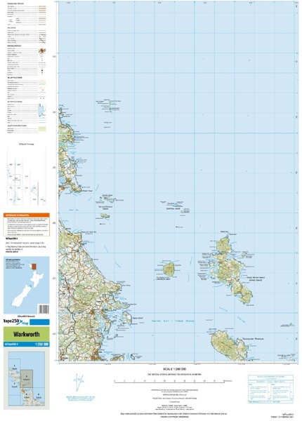
The Topo250 map series provides topographic mapping for the New Zealand mainland, the Chatham Islands, and offshore islands at 1:250,000 scale. Along with the paper-based Topo250 map series, digital images of the maps are also publicly available. Georeferenced raster digital images are provided at a resolution of 300 DPI. Georeferencing allows adjacent maps to be accurately and automatically aligned within GIS systems.
Format: Map
Imprint: Land Information NZ
Publication date: 09/09/2009